Description
!! Do not leave the page after you have completed checkout. The page will refresh with your download links!!
This map pack includes everything you’ll need to navigate the 79-mile Bob Marshall Chinese Wall Circuit.
- High-quality topographical maps to print out or download onto your phone.
- Detailed description of the route
- Dataset with mileage, and good places to camp
- .GPX track to import into your favorite navigation app
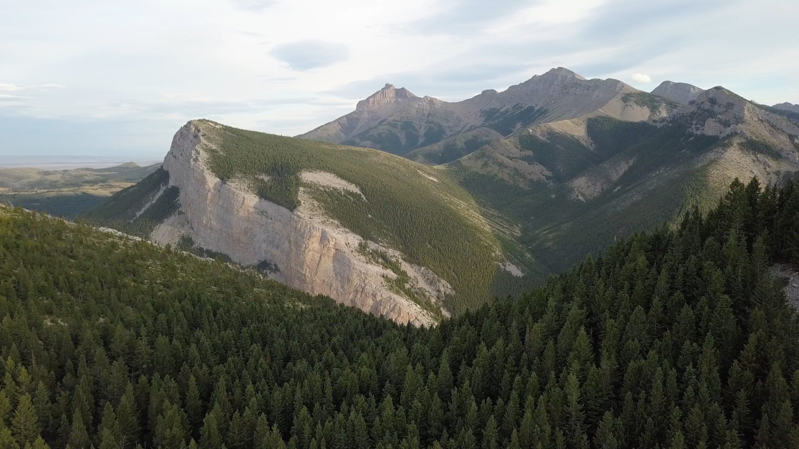
The Chinese Wall is an anomalous feature in the Bob Marshall Wilderness in Montana. A 12 mile-long 1,000-foot tall escarpment jutting straight up out of the ground. This route first takes you under the wall on the Continental Divide Trail, then back along the top of the wall completely off-trail. You'll be route-finding on top of the Chinese Wall and navigating around cliffs that break up the ridge of the wall. Below the wall, you'll be rewarded with towering cliffs, and above it, you'll have about two days of massive 360-degree views. Depending on the time of year you hike, you may meet some Continental Divide Trail thru-hikers who are just starting their 3,100-mile journey south to the Mexican border or CDT thru-hikers who are very close to the end of their hike, heading north to the Canadian border. Get the Bob Marshall Chinese Wall Map Pack today!
Click here and head back to the shop.
Click here to visit Wilderness Mindset Facebook.
Jon Waite –
Loved this. Just got back from the Bob a couple weeks ago. We came-in horse packing from the Silver Tip trail head along the Spotted River and made our way down to a place called Brushy Park (and old outfitters camp along the White River west of Salt Mountain that still had those artifacts). We did go back up to Larch Hill Pass along the White River looking for a trail that would take us to the westward-facing side of the wall – but couldn’t find anything that we didn’t have to bushwhack. We did come to a spot spot along the CDT where we could see the north side of Salt mountain and stopped there where the CDT continued down the east side of the wall – and there did seem to be a slope around the northern tip of the wall heading down to the base on the west side. That might of been the way. But we ran out of time and had to head back to Brushy Park before dark.
Can anyone please confirm this? My goal is to visit the site where my dad’s plane collided into the westward side of the wall at Salt Mountain (about 75′ from the summit). It was a number of years ago – but I’m hoping to find some fragments from that wreckage being a small, Mooney airplane that had aluminum parts. That would be at the westward base of Salt Mountain. Thanks for any info – we’ll try again next year.